
For as long as humans have taken to the sea, navigation has been one of the greatest challenges of maritime life. Knowing where you are, where you are going, and how to get there safely has determined the success—or failure—of voyages for thousands of years. From reading the stars and watching the waves to relying on satellites and digital charts, the ways ships navigate the ocean have changed dramatically over time.
For a maritime museum, the story of navigation offers a fascinating comparison between human skill, observation, and experience in the past and the advanced technologies that guide ships today.
Early Navigation: Learning From Nature
The earliest mariners navigated without maps, compasses, or instruments. Instead, they relied on careful observation of the natural world. Indigenous seafarers and early sailors watched the sun, moon, stars, winds, currents, birds, and even the color and movement of the water.
By tracking the sun’s position during the day and the stars at night, sailors could determine general direction. Coastal landmarks such as mountains, cliffs, and shorelines also helped guide vessels. This form of navigation required deep knowledge passed down through generations and a constant awareness of the environment.
While these methods lacked precision, they allowed people to travel vast distances long before modern technology existed.
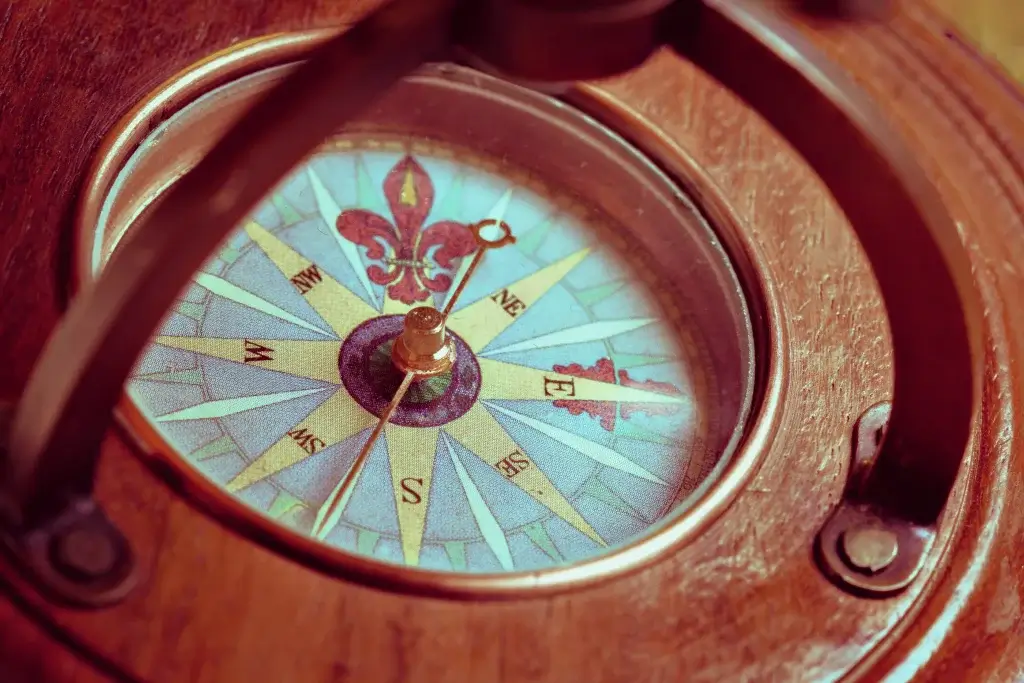
The Compass and Directional Travel
One of the most important breakthroughs in maritime navigation was the magnetic compass. Introduced to European sailors in the Middle Ages, the compass allowed mariners to determine direction even when stars or landmarks were not visible.
With the compass, sailors could maintain a steady course across open water. This innovation made longer and more reliable voyages possible, supporting exploration, trade, and cultural exchange. However, knowing direction alone was not enough—sailors still struggled to determine their exact position at sea.
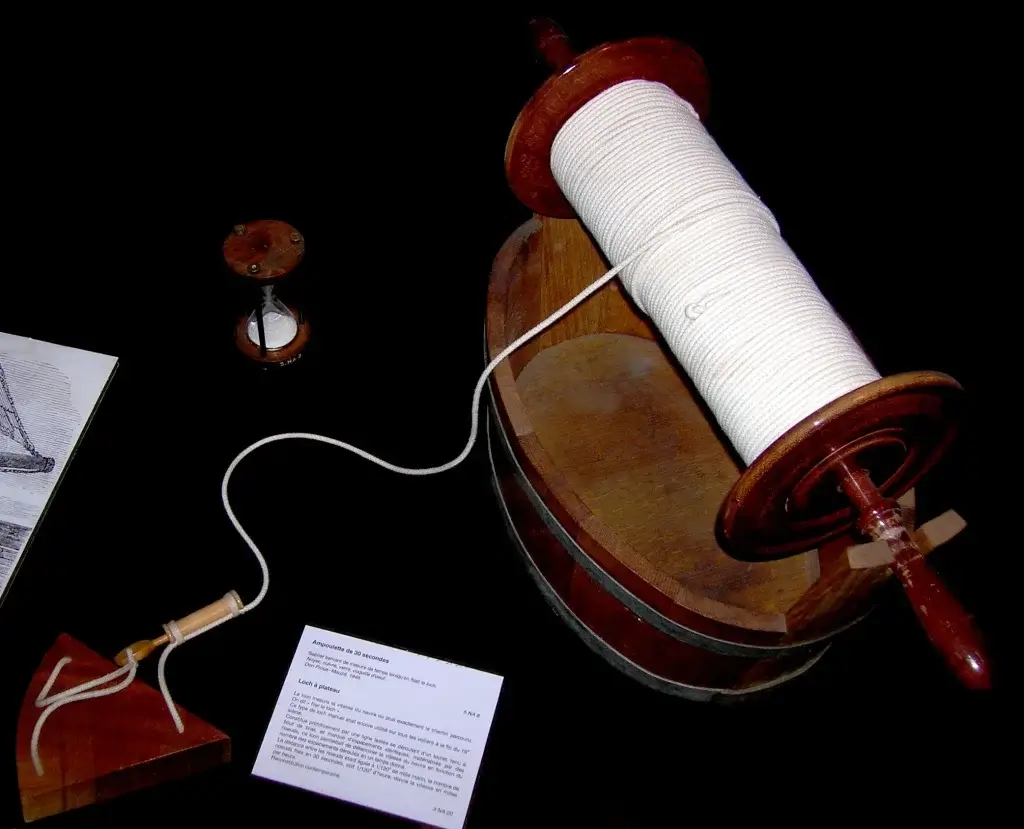
Dead Reckoning and Early Charts
For centuries, sailors estimated their position using a method called dead reckoning. This involved calculating distance traveled based on speed, time, and direction. Sailors used tools such as the log line—a rope with knots tied at regular intervals—to estimate speed, while sandglasses measured time.
These estimates were plotted on early sea charts, which showed coastlines, hazards, and ports. While helpful, dead reckoning was prone to error. Small mistakes in measurement could add up over long voyages, sometimes placing ships far from their assumed position.
Despite its limitations, dead reckoning remained a core navigation method well into the age of sail.
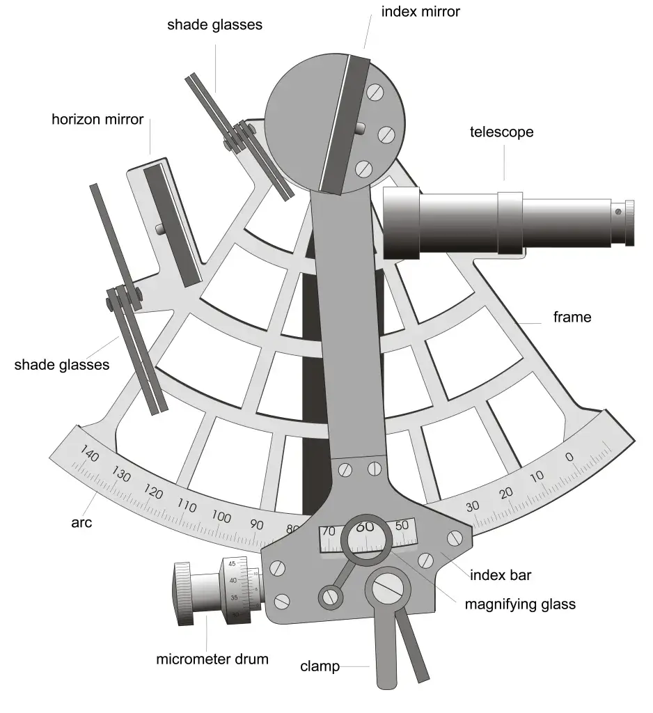
Celestial Navigation and the Age of Sail
Celestial navigation marked a major step forward in maritime navigation. By measuring the angle of celestial bodies—such as the sun at noon or specific stars at night—sailors could calculate latitude with increasing accuracy.
Instruments like the astrolabe, quadrant, and later the sextant allowed sailors to take precise measurements. Combined with navigational tables and almanacs, these tools helped mariners determine their position relative to the equator.
Determining longitude, however, remained a major challenge until the development of accurate marine chronometers in the 18th century. By comparing local time to a reference time, sailors could finally calculate longitude, making global navigation far safer and more reliable.
Navigation Skills and Human Experience
Even with instruments, navigation in the past relied heavily on human judgment and experience. Navigators needed strong math skills, an understanding of astronomy, and the ability to interpret changing weather and sea conditions.
Errors in calculation, damaged instruments, or cloudy skies could quickly put a ship off course. Successful navigation required constant attention and adaptability, making navigators among the most respected members of a ship’s crew.
Maritime museums often preserve navigational tools and logbooks that reveal the skill and discipline required to guide ships across the ocean before electronic aids.
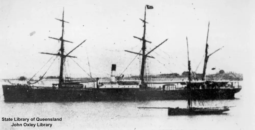
The Transition to Modern Navigation
The late 19th and early 20th centuries brought new technologies that began to transform maritime navigation. Steam power reduced dependence on wind, allowing ships to follow more predictable routes and schedules.
Advances in chart-making, standardized timekeeping, and improved compasses increased accuracy. Radio communication allowed ships to receive weather updates and signals from shore, reducing isolation at sea.
These developments marked a transition period, blending traditional navigation skills with emerging technology.
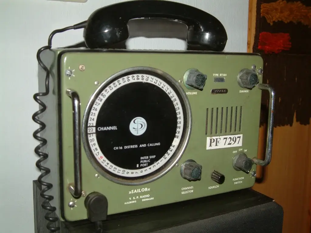
Radar, Radio, and Electronic Aids
During the 20th century, navigation entered the electronic age. Radar allowed ships to detect land, other vessels, and obstacles even in poor visibility. Radio navigation systems helped mariners determine position using signals transmitted from shore stations.
These tools greatly improved safety, especially in crowded shipping lanes and during bad weather. Navigators could now “see” beyond their immediate surroundings, reducing the risk of collision and grounding.
However, navigators still needed training to interpret electronic data correctly and respond when systems failed.
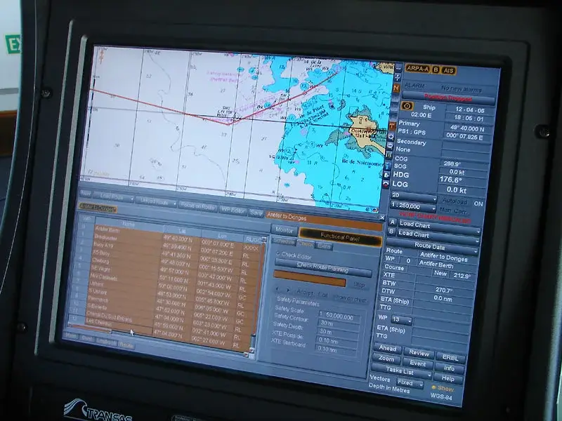
Satellite Navigation and GPS
Today, most ships rely on satellite-based navigation systems, including the Global Positioning System (GPS). GPS provides real-time location data with remarkable accuracy, allowing ships to know their exact position anywhere in the world.
Electronic chart display systems integrate GPS data with digital maps, weather information, and traffic monitoring. Automated systems can track routes, optimize fuel use, and alert crews to potential hazards.
Modern navigation has made global shipping faster, safer, and more efficient than ever before.
Navigation in the Modern Maritime World
While technology dominates navigation today, human expertise remains essential. Mariners must understand how systems work, recognize errors, and navigate safely if technology fails.
Modern training emphasizes both traditional skills—such as basic chart reading—and advanced digital tools. This combination ensures that today’s navigators can adapt to a wide range of conditions.
Maritime museums often highlight this balance between old and new, showing how centuries of navigational knowledge still influence modern practice.
Comparing Past and Present
The contrast between past and present navigation highlights how far maritime technology has advanced. Early sailors depended on observation, memory, and courage, while modern mariners rely on satellites, computers, and global communication networks.
Yet both approaches share a common goal: safely guiding ships across vast and unpredictable oceans. The principles of awareness, preparation, and respect for the sea remain unchanged.
Conclusion
The history of ocean navigation is a story of human ingenuity and adaptation. From reading the stars to following digital charts, each generation of sailors built upon the knowledge of those who came before.
For maritime museums, navigation offers a compelling way to connect past and present. By exploring how ships once found their way—and how they do so today—visitors gain a deeper appreciation for the skill, technology, and experience that continue to guide ships across the world’s oceans.